Heat Maps Feature
(video below – 3 minutes long)
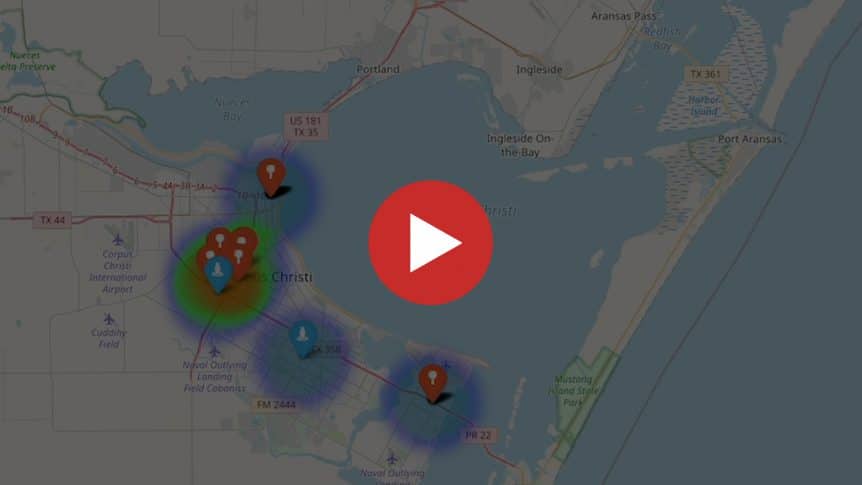
Welcome back to the GangScope video series. This video is our 5th and final video of our videos series. We hope these videos have helped demonstrate some GangScope features that can help you and your team solve crime faster. This last video highlights GangScope’s Heat Maps, one of our most popular features. The HeatMaps are a powerful analysis tool to visually understand crime geographically.
How can heat maps help?
- Leverage historical data to develop trends centered around geographical locations
- Create level 1 Predictive Policing which can open up the benefits of tracking and analyzing incident data
- Enhance the ROI (return on investment) as data becomes more useful than just something you search upon. It can now visually show where traditional policing resources may need to be best deployed.
- Create more engagement by presenting visual information instead of having to just read statistics
WATCH THE TOOL IN ACTION

Heat Maps help you understand geographically where crime has occurred and can identify the likelihood of future outcomes based on that historical data. The goal is to go beyond visually understanding what has occurred to provide solid assessments of what will happen in the future.
To learn more or to schedule a full demo of our system – request a demo here. We would welcome the opportunity to show you how Gangscope can help your department organize and store your data in a secure and compliant way.
The GangScope Team